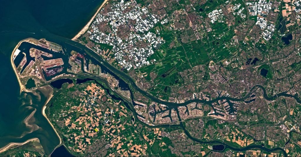
Satellite technology has improved significantly over the years. Almost every country has launched a satellite into space and even individuals and businesses. This has helped us to be able to monitor climate change, protect the environment, prevent disasters, manage businesses, and much more. As technology advances, access to satellite images and data becomes more accessible and affordable.
According to Allied Market Research, the benefits and importance of satellite imagery will only continue to increase. This is because many companies now understand how it can help their business, and it also has a crucial role in fighting against climate change. All of these increase the demand for the services of satellite image providers. For example, EOS Data Analytics is one of the most popular satellite image providers that launches its own agriculture focused 7 satellites via the EOS Sat project. The company also has a digital tool called LandViewer for searching, analyzing, and downloading satellite images, catering to the needs of different industries.
Table of Contents
Earth Observing Satellites (EOS)
These satellites are created for monitoring the earth from its orbit. Some of them can take pictures similar to aerial photographs. So, on which altitudes are these satellites launched and why?
In general, an EOS is launched above 600 km altitudes. Anything below 600 km is not good for satellites because of high air drag. To obtain coverage of the whole earth, the satellite must be placed at the polar orbits or nearby. They rotate from north to south or vice versa and complete their orbit several times a day. For them to stay in their orbit, they need to move at higher speeds than those at higher altitudes. To obtain coverage of about one-third of the earth, some satellites are kept in geostationary orbits. Meteorological satellites are held at altitudes of 36000 km in geostationary orbits and rotate along the equator.
There are many different types of earth observation satellites according to their applications. Weather satellites are made to keep tabs on our climate. These meteorological satellites stay in the geostationary orbit. An EOS is used to monitor our environment and detect changes in vegetation, ocean colors and temperatures, and ice film present in polar orbits.
How to choose a satellite image provider
Due to the ease of access to satellite images and the countless number of satellite providers, it has become challenging to find a good satellite image provider. However, some criteria can be used to determine the provider that will be best for you, such as the spatial resolution, spectral resolution, temporal resolution, and positional accuracy.
Spatial resolution
This is among the most important parameters to look for when checking satellite imagery. Spatial resolution is the level of detail that can be gotten from an area the sensors are focusing on. It is the size of a pixel of the earth’s surface. It is also often referred to as Ground Sample Distance. The smaller the GSD, the better the details that can be seen. That is why it can be divided into three categories – Low: more than 60m/pixel, Medium: from 10 – 30 m/pixel, and High: from 30 cm – 5m/pixel. For example, taking into consideration that the size of a soccer field is 100m x 100m. If a satellite with a spatial resolution of 100m is viewing a lot, very little or no details of that field will be seen. However, if the spatial resolution is 5m, almost all the details on the field will be visible.
Spectral resolution
Spectral is related to the electromagnetic spectrum, which includes light that is both visible and invisible to human eyes. The typical camera we use measures and records visible light that objects like trees and rocks reflect.
Scientists use imaging spectrometers on satellites to measure changes in things that impact our environments, like water quality and vegetation cover.
The EMS is composed of thousands of wavelengths of energy. Visible light is contained in the blue, green, and red portions of the spectrum. The rest of the spectrum is not visible to human eyes but can be detected and recorded by imaging spectrometers. There are thousands of wavelengths to record in the electromagnetic spectrum. To deal with all these wavelengths, imaging spectrometers divide this spectrum into groups of wavelengths called bands. The width and number of bands are what we call the spectral resolution of an image. Higher spectral resolution means more bands that are spectrally narrow. Lower spectral resolutions mean fewer bands, each covering more of the spectrum.
Temporal resolution
This is the time required to revisit and acquire data for the same location. The revisited period of a satellite is usually several days. When applied to satellite imaging, the amount of time of the revisiting periods depends on the orbital characteristics of the sensor platform. So, the more accurate data will be provided by the satellites that visit the same place frequently.
Positional accuracy
It is calculated as a root-mean-square error (RMSE) and is important when comparing your data to existing projections. Satellite imagery will not be beneficial in mapping if the positional accuracy is low. This is because there will still be lots of work to be done manually on the ground. The HxGN Content Program provides a 15cm resolution picture with less than 1m RMSE, compared to the best resolution satellite picture with 30cm resolution having an accuracy of 3 – 5m CE or more.
So, when deciding which satellite image provider to choose, you need first to understand the type of images you need. Then check if the provider has the technology to provide you with the required images.
