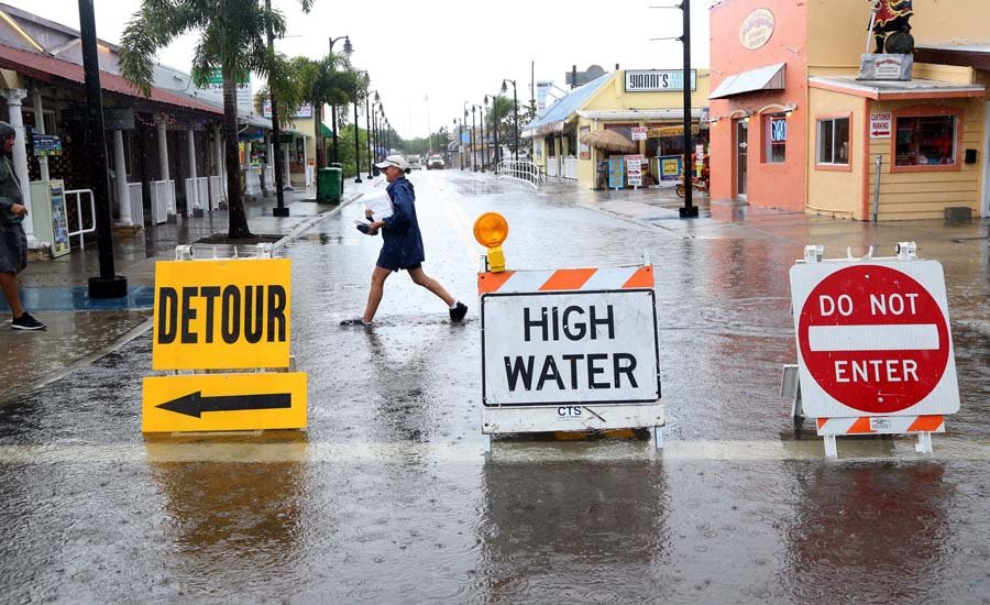
About 8.7 million properties are located in a potential flood zone, however, experts say that up to 14.6 million could be at risk of flooding in the near future.
Understanding flood zone determination, if your home is at risk, and ways to protect your property with insurance is essential for everyone.
Learn what is a flood zone below to get protected now.
Table of Contents
What is a Flood Zone?
The simple definition of a flood zone is areas that are more likely to flood. However, just about any land is prone to flooding. A flood map shows the range of probability of flooding, according to FEMA (Federal Emergency Management Agency.) The map classifies areas into flood zones to display if the property is at a low, moderate, or high risk of flooding.
This classification is used for flood insurance purposes — whether you are required to have it and how much it costs — as per FEMA guidelines.
Before going through each zone classification here are some terms to understand about flood zones.
Flood Terminology
FEMA uses certain acronyms and labels to discuss the characteristics of flood zone types and the general mapping of these zones. This terminology is useful for determining flood insurance rates.
Flood Insurance Rate Map (FIRM)
A FIRM is the official FEMA map of various flood zones within your area. They get updated often as conditions change so reclassification is possible. View this map occasionally to see if your area has become prone to flooding or increased in risk.
National Flood Insurance Program (NFIP)
Regular property insurance does not cover damages due to flooding. Therefore, FEMA created a standardized federal insurance program called NFIP. The program has insurance agents that sell coverage to home and business owners to protect their property from flooding.
There is a 30-day waiting period to gain insurance from NFIP. This means that you need to buy the insurance before flooding occurs well in advance. Knowing if you are in a flood zone is key to being financially protected from damage.
Special Flood Hazard Area (SFHA)
SFHA areas are also called floodplains. They are zones that have the highest risk of flooding, according to FEMA. Therefore, the government requires flood insurance for these areas.
Coastal Barrier Resource System (CBRS)
The CBRS restricts building in these areas. The natural coastal barriers act as flood protection for inland properties, therefore, they cannot be disturbed.
Base Flood Elevation (BFE)
A BFE is the rate at which the area can flood over X amount of time as determined by a FEMA assessment.
Flood Zones
FEMA flood zones are generally classified under letter groups, including:
Zone A: High-risk areas
Zone B or Shaded X: Moderate-risk areas
Zone C or Unshaded X: Low-risk areas
Zone V: High-risk coastal areas
Zone D: Unevaluated areas
Each zone is discussed in detail below.
Flood Zone A
Property under a flood zone A classification has a 1% chance of flooding each year. The general A zone does not have a BFE, but the sub-zones under A do have specific BFEs.
These sub-zones include:
AE (previously A1-A30): 1% chance of flooding annually with BFEs
AH: one- to three-foot pools with BFE intervals
AO: located near rivers or streams with one- to three-foot pools
AR: temporary risk while levees or dams are restored
A99: near dams or levees that are complete or almost complete
All zone A sub-categories are in flood insurance areas so they require NFIP participation. They are marked under the 100-year flood probability as there is a 1% chance of a flood each year, making at least one flood likely in a century.
Flood Zones B or Shaded X
These areas are considered moderate risk since they are classified as 100-year to 500-year flood zones. Levees protect these areas so they only cause shallow flooding of less than one foot. Drainage is also less than a square mile.
Because these areas of not high risk and are protected naturally they are not part of an SFHA and do not require flood insurance.
Zone C or Unshaded X
Being low-risk areas, zones C or unshaded X area have a .2% chance of flooding annually. Some ponding may occur as well as draining issues. Zone X is beyond the 500-year flood probability. It also is protected from the 100-year flood by levees.
Zone V
This zone is also high-risk like zone A, but it is classified separately. The difference is that properties in zone V are located on the coasts and pose a higher risk due to waves and windy conditions. Like zone A, zone V lists no BFEs until you look at the sub-categories which range similar to zone A.
VE (V1-V30) zones have numbered BFE zones and have a 1% percent chance of flooding. these areas like zone A have mandatory flood insurance requirements.
Zone D
Since these areas are not assessed by FEMA, there is no mandatory insurance. However, this does not mean that these areas are free from flooding. They are only classified as “other” to show the unknown risk in these areas.
Do You Require Flood Insurance?
If your property falls under the SFHA zones A or V then you are required to own insurance. However, you can also purchase insurance regardless of your zone.
Having insurance ensures that your home or business is protected even when the probability of flooding is low. Classifications are always changing so you should be prepared. Even small flood damages can be expensive, so you need to weigh the risk against the cost of repairs.
Finding Your Flood Zone
Now that you know what is a flood zone you might need to look up where your property lies. Contact your agent at the NFIP, look on your home deed or building lease for flood classification, or search for a flood map online on your state or local website.
Check out our house section for more ways to protect your home from the elements.
